What if forestry yield estimates could be calculated sitting in front of a computer using Virtual Reality (VR) technology, rather than going out into the field? Source: Timberbiz
A FWPA funded project looking into exactly that has recently been profiled in the Brazilian forestry publication Referência Florestal Magazine.
Researchers from the University of Tasmania and others are collaborating in two current FWPA projects, conducting a study that links forest inventory data, dense point cloud data processing and VR.
The research is an extension of the FWPA project Deployment and integration of cost-effective, high spatial resolution, remotely sensed data for the Australian forestry industry, and brings in the expertise of the University of Tasmania’s HITLAB.
The research is also closely connected to the work of another FWPA project, Optimising remotely acquired, dense point cloud data for plantation inventory.
Currently still in the feasibility stage, the project is investigating the potential of immersive VR in three key areas: the rendering of dense 3D point cloud data, the development of tools to extract 3D tree measurements, and the potential application of VR to stem quality assessments.
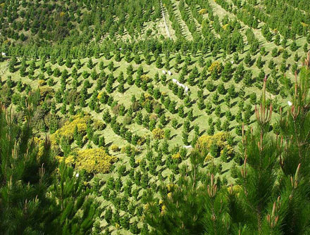
The project is working with P radiata dense point cloud data acquired from a variety of terrestrial and aerial platforms and sensors.
The aim is to assess the capability of VR technologies and workflows to increase operational efficiency, as well as to improve occupational safety of inventory crews.
Researchers believe there is the potential to fundamentally change the way forest inventory operations are managed.
A report on the project’s findings will be published in December.
If the research demonstrates real value in VR methods, the researchers hope to secure further funding to progress the research and development, with the goal of effectively integrating VR into operational workflows.


